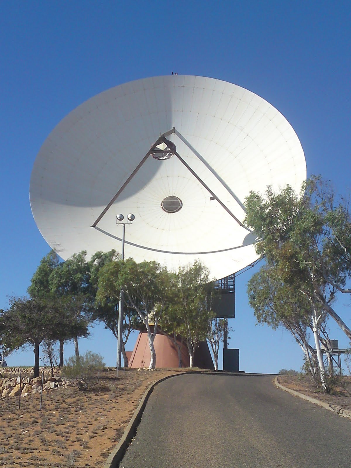
As you go north the distances become longer and longer between each point of interest. It is not uncommon to drive a whole day. Our first stop on the long road to Darwin was a mining town called Tom Price. The town itself is not that interesting unless you are into mining. One of the worlds biggest mines are located here, a Rio Tintio open cut iron ore mine. From shopping at the local supermarket it became clear that mining is what everyone works with.

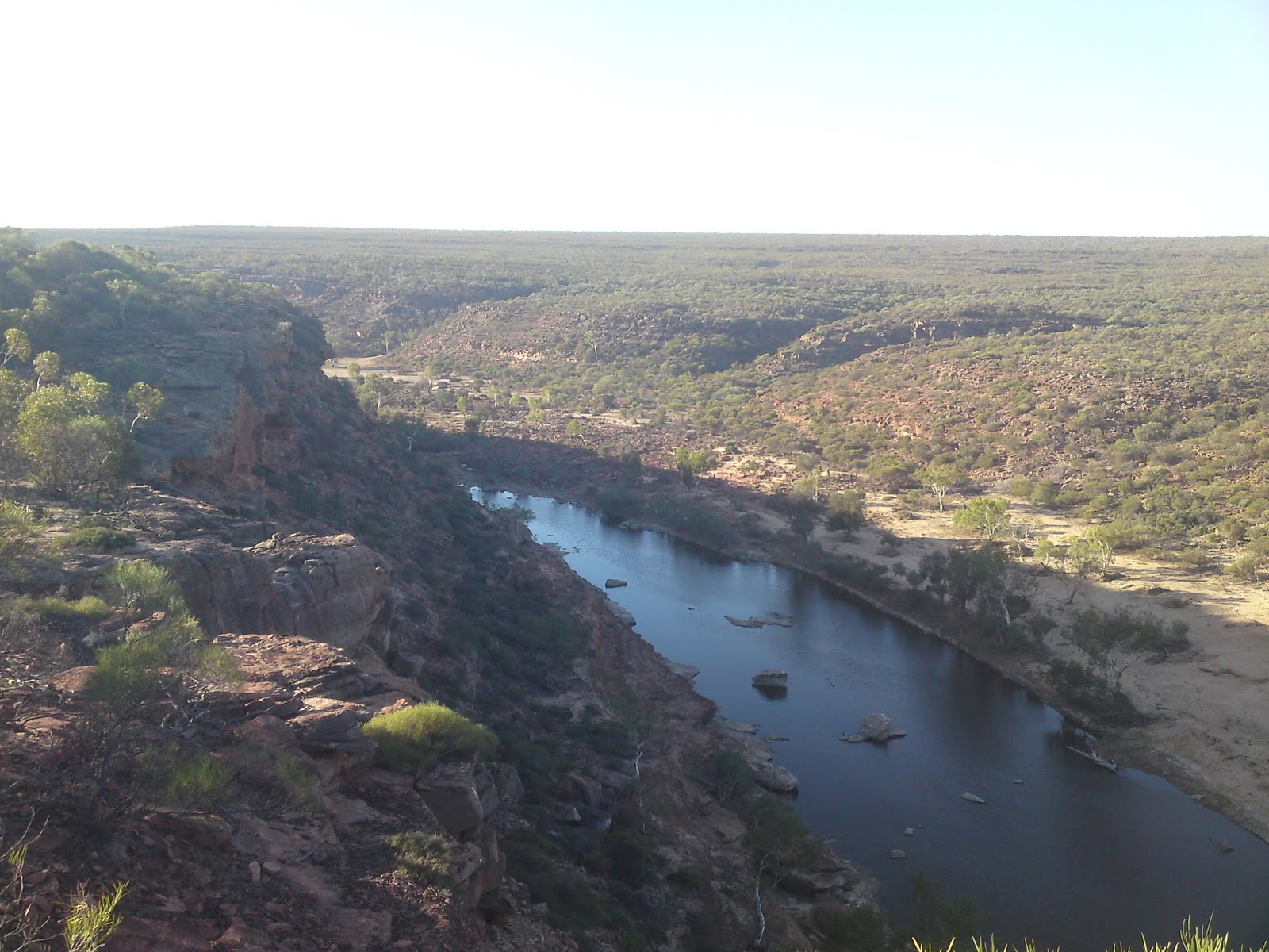
It was the Karijini national park that we wanted to visit and it is only a hours drive away from Tom Price. So the next morning after camping outside of town we headed towards Karijini. Karijini is one of the more remote national parks and the roads are gravel and in bad condition. It was a shaky drive between the different lookouts. One of the most impressive lookouts was called Oxer lookout. Here four gorges meet and the view is spectacular. Deep down in the gorge the water is slowly running and tall trees are growing, but up where we were standing there was just bushes.


Karijini national park is filled with gorges and they are the main attraction. We drove around to the different ones and took in the breathtaking views. Our last stop was a place called Fortescue Falls. The path took us down into the gorge where the water came down a waterfall. There was a pool at the bottom and we both went swimming. The water was nice and warm and you could swim right up to the falls and sit there. Above the falls the cliffs formed an amphitheatre and here you could sit and dry off in the sun. It was a really nice place.
It took us another whole day of driving to reach the next town, Port Hedland. Port Hedland is also an industrial town. All the iron ore from around Tom Price gets shipped here by train and then loaded into boats. There is also a big salt factory here. I didn't find Port Hedland that interesting either, we spent the day at McDonald's, surfing on their free wifi.


From Port Hedland it took another whole day of driving to reach Broome. We wanted to camp just outside Broome in the Dampier Peninsula, but it had been raining that day and the woods were full of mosquitoes. It sounded like a bee hive inside our car and it was impossible to sleep. We had to pack up and drive into Broome where we camped in the parking lot outside Woolworth (Supermarket). The next day we showered at Cable Beach, Broome's beautiful beach, before heading to Gantheaume Point just outside town. Here it is possible to see dinosaur footprints in the rocks when the tide is extremely low. The picture is from a replica located further up. The landscape here was wild with rocks next to the ocean.

We went back to Cable Beach in the afternoon. We swam in the warm ocean and I played soccer with a group of Danish and Italian backpackers. We then watched the sunset over the beach. Apparently this is a pretty popular thing to do, because close to a hundred people had shown up to see it. That night we tried to wild camp again in a different parking lot, but a person found us and asked us to leave. We moved to another location and this time we were not disturbed until the next morning when the ranger came around and asked everyone to leave. There was not much else to do in Broome, its not a big city and there are not that many attractions, so we headed east towards the WA/NT border.


The first town east after Broome is half a days drive away and called Fitzroy Crossing. Not far from Fitzroy Crossing is the Geikie Gorge national park. This is a beautiful place where the Fitzroy river runs through the gorge. The stone which was once a coral reef many millions of years ago is colored half white and half dark. The lower half is the white part. It looked really nice with the steep stone walls next to the water and the dried river bank. We went for a nice walk up along the river.


Heading east again the next town is called Halls Creek. It had kept on raining and the two main attractions around Halls Creek were closed because of the gravel roads. One was the Purnululu national park (Bungle Bungles) and the other the Wolfe Creek meteorite crater. However the weather ahead looked promising so we decided to wait. That night we camped at a place just outside Halls Creek called Caroline Pool, a natural waterhole. The next morning we checked out the old Halls Creek town site. The only thing that was left was the stone foundations. Halls Creek was the first place were gold was found in Western Australia and was a thriving town during the gold rush days in the late 1800. However when the majority of the gold ran dry, so did the people, and the town moved next to the highway. We also went to a place called China Wall where a sub vertical quartz vein comes up from the ground forming what look's like a wall.


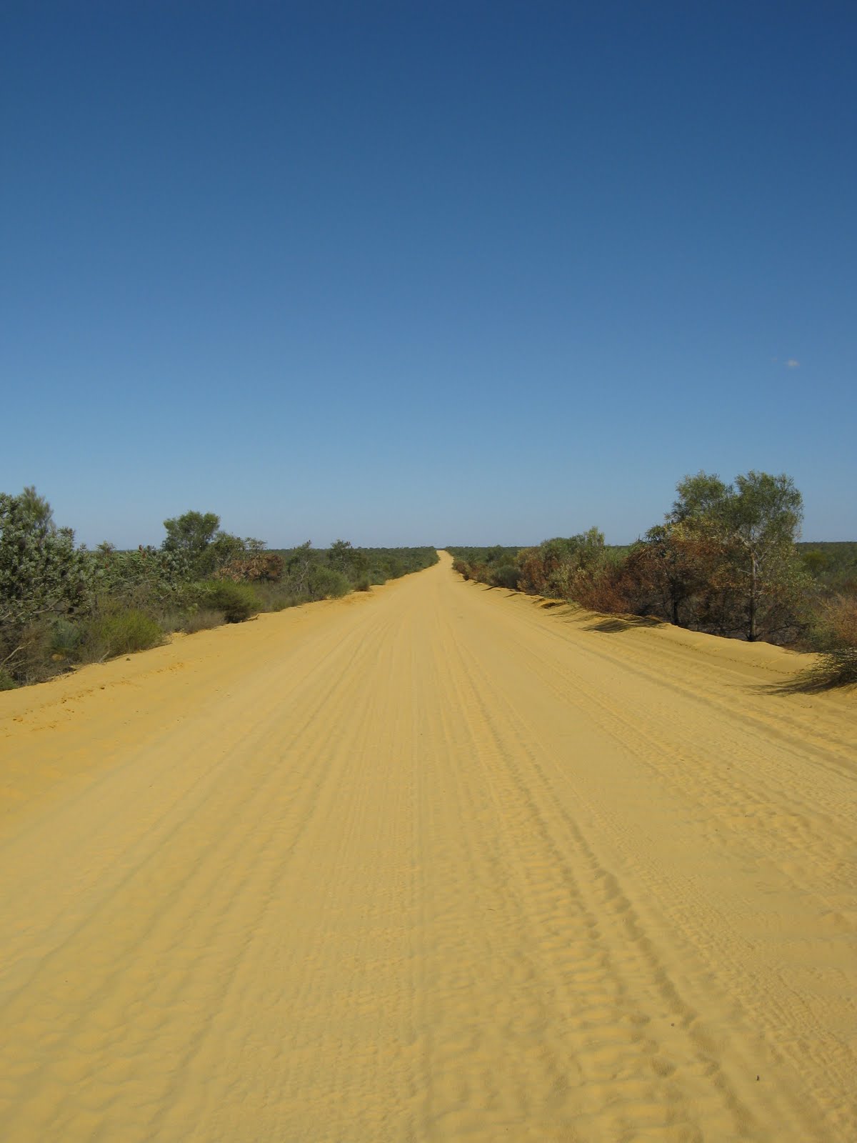
We were quickly becoming bored of Halls Creek and decided to go to the Wolfe Creek crater even if the road was closed. It turned out to be an interesting, mentally exhausting and challenging drive. This gravel road was nothing like the other ones I have driven. It was shaky, rocky, muddy and overall bad quality and at places the road was still almost flooded. The worst part was that it was 130km of this road to the crater. But we got there safely and without getting stuck or damaging the car. The Wolfe Creek meteorite crater is the second largest in the world and is truly breathtaking. Just a short walk up the outer side reveals a large circular hole in the ground now covered with grass and small trees. The crater is over 880 meters wide and when the crater was new some 300.000 years ago the hole was up to 120 meters deep. But wind has filled it with sand and it is now around 20 meters under the surrounding terrain. That night we camped next to the crater before driving the 130km of shitty dirt road back.


We had to skip the Purnululu national park because it was still closed and here there was no possibility to drive on a closed road without getting into trouble. Instead we headed north from Halls Creek towards the border town of Kununurra. In Kununurra we walked in the Celebrity Tree Park and found the tree that Baz Luhrmann, the director of the movie
Australia, had planted when filming the movie in the east Kimberley region. The east Kimberley region being the region roughly from Halls Creek to Kununurra. The landscape around us as we drove through the Kimberley was amazing. The hills and mountains look so different from back home and the highway snakes itself around them displaying one great view after another.
The only known deposits of a rare rock called Zebra rock is found in the east Kimberley region. A rock with characteristic stripes of white and brown. We visited a gallery in Kununurra that made all sorts of nice things with the Zebra rock. I took some pictures to try and show what the rock looks like and what they made from it.

The last thing we did in Kununurra and Western Australia for that matter was visiting the Mirima national park. It is also called Hidden Valley and is located right next to the city. It was a nice place with a short walk up to a great lookout spot of the town and the valley. Kununurra is the end of the north west and the end of this blog post. We are now entering Northern Territory, but I will write about that in my next update.


 Karijini national park is filled with gorges and they are the main attraction. We drove around to the different ones and took in the breathtaking views. Our last stop was a place called Fortescue Falls. The path took us down into the gorge where the water came down a waterfall. There was a pool at the bottom and we both went swimming. The water was nice and warm and you could swim right up to the falls and sit there. Above the falls the cliffs formed an amphitheatre and here you could sit and dry off in the sun. It was a really nice place.

 From Port Hedland it took another whole day of driving to reach Broome. We wanted to camp just outside Broome in the Dampier Peninsula, but it had been raining that day and the woods were full of mosquitoes. It sounded like a bee hive inside our car and it was impossible to sleep. We had to pack up and drive into Broome where we camped in the parking lot outside Woolworth (Supermarket). The next day we showered at Cable Beach, Broome's beautiful beach, before heading to Gantheaume Point just outside town. Here it is possible to see dinosaur footprints in the rocks when the tide is extremely low. The picture is from a replica located further up. The landscape here was wild with rocks next to the ocean.

 The first town east after Broome is half a days drive away and called Fitzroy Crossing. Not far from Fitzroy Crossing is the Geikie Gorge national park. This is a beautiful place where the Fitzroy river runs through the gorge. The stone which was once a coral reef many millions of years ago is colored half white and half dark. The lower half is the white part. It looked really nice with the steep stone walls next to the water and the dried river bank. We went for a nice walk up along the river.
 Heading east again the next town is called Halls Creek. It had kept on raining and the two main attractions around Halls Creek were closed because of the gravel roads. One was the Purnululu national park (Bungle Bungles) and the other the Wolfe Creek meteorite crater. However the weather ahead looked promising so we decided to wait. That night we camped at a place just outside Halls Creek called Caroline Pool, a natural waterhole. The next morning we checked out the old Halls Creek town site. The only thing that was left was the stone foundations. Halls Creek was the first place were gold was found in Western Australia and was a thriving town during the gold rush days in the late 1800. However when the majority of the gold ran dry, so did the people, and the town moved next to the highway. We also went to a place called China Wall where a sub vertical quartz vein comes up from the ground forming what look's like a wall.
 We were quickly becoming bored of Halls Creek and decided to go to the Wolfe Creek crater even if the road was closed. It turned out to be an interesting, mentally exhausting and challenging drive. This gravel road was nothing like the other ones I have driven. It was shaky, rocky, muddy and overall bad quality and at places the road was still almost flooded. The worst part was that it was 130km of this road to the crater. But we got there safely and without getting stuck or damaging the car. The Wolfe Creek meteorite crater is the second largest in the world and is truly breathtaking. Just a short walk up the outer side reveals a large circular hole in the ground now covered with grass and small trees. The crater is over 880 meters wide and when the crater was new some 300.000 years ago the hole was up to 120 meters deep. But wind has filled it with sand and it is now around 20 meters under the surrounding terrain. That night we camped next to the crater before driving the 130km of shitty dirt road back.

 We had to skip the Purnululu national park because it was still closed and here there was no possibility to drive on a closed road without getting into trouble. Instead we headed north from Halls Creek towards the border town of Kununurra. In Kununurra we walked in the Celebrity Tree Park and found the tree that Baz Luhrmann, the director of the movie Australia, had planted when filming the movie in the east Kimberley region. The east Kimberley region being the region roughly from Halls Creek to Kununurra. The landscape around us as we drove through the Kimberley was amazing. The hills and mountains look so different from back home and the highway snakes itself around them displaying one great view after another.

 The last thing we did in Kununurra and Western Australia for that matter was visiting the Mirima national park. It is also called Hidden Valley and is located right next to the city. It was a nice place with a short walk up to a great lookout spot of the town and the valley. Kununurra is the end of the north west and the end of this blog post. We are now entering Northern Territory, but I will write about that in my next update.