I know I said my last post was the final one, but then I realized that I forgot to post all the videos I have made during my travels. I have know uploaded some to my youtube profile and some to my vimeo profile. I have included the best ones in the bottom of this post, but you can also look at my profiles for the rest of my videos. I have also updated most of the photo albums in my Picasa profile with photos taken with Annina's camera. Be sure to check those out as well as some have more than double as many photos now.
Days Like This!, Australia, January 2010:
Great Barrier Reef, Movie one from Audun Michael knudsen
The Dolphins at Monkey Mia, Movie two from Audun Michael knudsen
Seagull flying next to our boat on the Whitsundays from Audun Michael knudsen
Showing posts with label Information. Show all posts
Showing posts with label Information. Show all posts
Saturday, August 7, 2010

Wednesday, August 4, 2010
The Last One


 There is a spot not far from Harbour City where the best pictures of the Opera House and the Harbour Bridge can be taken together. If you see both icons together on a postcard or similar it is from this spot that the picture originated. We both agreed that we couldn't leave Australia without visiting this place and take our own photos. So one afternoon we decided to go for a walk and do it. I think going in the morning would have given us better photos because in the afternoon the sun was right in our faces. We made the best we could out of it before continuing our walk around the Botanical Gardens and coast.
East Coast: 29. June 2010 - 20. July 2010
http://picasaweb.google.com/fatsheep/EastCoast
Sydney 4: 21. July 2010 - 04. August 2010
http://picasaweb.google.com/fatsheep/Sydney4
Saturday, July 31, 2010
Back in Sydney (32468km driven)


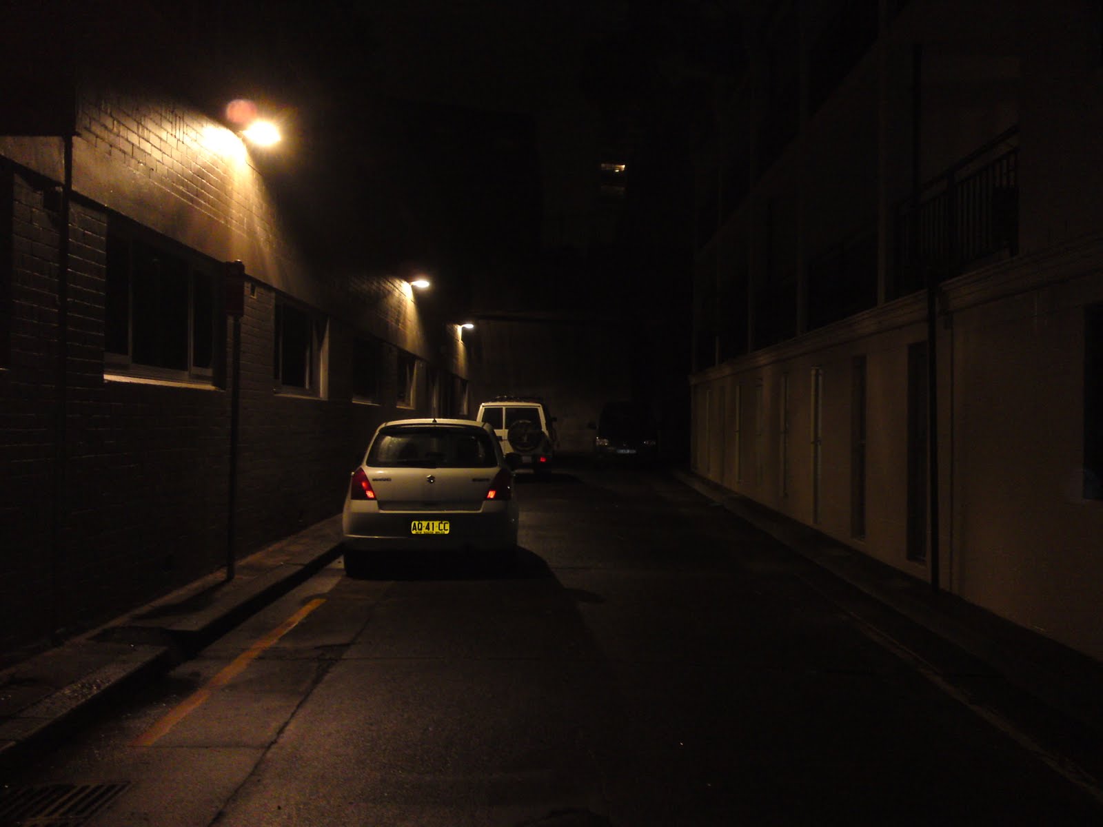 Our first task in Sydney was to sell the car. We had exactly two weeks and we hoped that that would be enough time. The first thing we did was put the car on different add sites and print out posters to hang in different hostels and travel agents around Sydney. We had only one response the first days and that turned into nothing, so a couple of days later we decided to try and park the car along the famous car selling strip in Kings Cross. It was there me and Kristin found the car in the first place. We sat there for about five hours without anybody even looking at the car, then suddenly an English guy showed up and wanted to have a look. After he had a mechanic look at it and we discussed the price, he ended up buying it from us. We were really happy because we heard a lot of stories about people that tried to sell their car for 3-4 weeks with no luck. Finally we could take all our stuff out of the car and movie into a hostel, a welcoming change from living in the car for so long! The pictures are of our bed in the car (that we slept in for four months) and the alley we camped in. All together we drove 32.468km in the five months I owned the car!
 I never went to the Chinese garden during the time I lived in Sydney so me and Annina decided to go there and check it out. The garden is located in Darling Harbor and it was easy to find. The gardens full name is the Chinese Garden of Friendship and it was built to celebrate the Chinese community in Sydney and the close relationship with Guangzhou, a city in the Guangdong Province, China. From the outside it looks fairly small, but once inside the walls you realize that it has some size. I found the Chinese garden very beautiful with a lot of Chinese art, architecture and plants making the walk through the garden diverse and fascinating. Normally I am not the biggest garden visitor, but I enjoyed it. Be sure to check out the "Sydney 4" album when I post it to see more photos from our visit.
 Another thing that we said we would do but never did during my time living in Sydney was the walk between Bondi and Coogee beach. So as soon as we had a day with some blue sky we got on the bus to Coogee. The path follows the coast running in and out of small bays and over cliffs and beaches. The best known beach along the track (not counting Coogee or Bondi) is Bronte beach. The weather was great considering the rain we had the last week but the water and air temperature was still to cold for swimming. It took us about 1.5 hours to complete the walk and we enjoyed it a lot! About half way the path ran next to a huge cemetery. It was a spectacular sight to see the graves in the hillside, from the top of the hill to the cliff edge with the ocean below. Almost at the end the path rounds a sharp corner and Bondi Beach comes into full view down below the cliffs. It was beautiful.
The last thing I will write about in this blog post is the two movies we watched in the cinema. Annina wanted to watch another movie in the IMAX and I am not the person to say no to an IMAX experience, so we bought the cheap cinema vouchers on eBay again and went to watch Toy Story 3. I love 3D movies when they don't misuse the 3D effect and Toy Story 3 was a great example. I will try and get a review up on my movie blog so keep an eye out for that. :) Being a fan of Christopher Nolan (Memento, The Dark Knight) I got very excited when I realized that his newest movie Inception had just been released. And since Tuesdays are 40% off we decided to go watch that as well.

Thursday, July 1, 2010
In and around Cairns (28896km)


North of Cairns

 As soon as we got money again we headed north towards Port Douglas and Cape Tribulations. Our first stop was a beach called Trinity beach. Trinity Beach is a nice little beach about 20 minutes north of Cairns. We spent the morning swimming, relaxing and getting some tan again after a prolonged period away from the coast. We then continued on to a small town called Port Douglas. In Port Douglas we walked along the four mile beach and found coconuts that we could open. Opening a coconut proved to be a bit more difficult than first anticipated. But in the end we had a cup full of coconut milk and coconut to eat as well. To my surprise fresh coconut tastes more like almonds than anything else. The whole process took about a hour, but now I can say I have opened a coconut by my self.

 We left Port Douglas that day and headed towards Mossman Gorge. Mossman Gorge is located in the south tip of the Daintree rainforest, a part of the world heritage listed Tropical North Queensland. Mossman Gorge is not really what I would call a gorge but it is still a beautiful place. The Mossman river trickles through the rainforest forming nice swimming holes and beautiful scenery. There is also a nice rainforest walk around Mossman gorge that we enjoyed. The rainforest is full of cool looking trees and vines growing around each other. We went for a swim after the walk, but the water was very cold so it was just a short dip under. It was so new and different to see a rainforest like the Daintree national park after coming from the red centre where there are hardly any trees at all.
 From Mossman Gorge we decided to go north to Cape Tribulation. Cape Tribulation is another piece of the Daintree national park where the forest meets the ocean. To get there we first had to take a "ferry" across the Daintree river. Then drive a narrow and winding road through the hills along the coast. We stopped at the highest point of the road where a lookout has been made. Here we could see out over Cape Tribulation's beaches, rainforest and coastline. We spent the day exploring the cape, including boardwalks through the rainforest, beaches and more lookouts. The wet tropic coastline is home to a large flightless bird called the Southern Cassowary. It looks a bit like an Emu, but has a distinctive blue head. The Cassowary is almost extinct because of loss of habitat, dogs and traffic accidents. In the dusk before we camped we got lucky and saw a Cassowary with it's baby walking at the side of the road!


 Cooktown has it's name from Captain Cook, the man who first made European contact with eastern Australia. While exploring the region he crashed on the Great Barrier Reef and damaged his boat. The crew had to go to shore and fix the boat and the spot they chose is now Cooktown. Originally we hadn't planned to go to Cooktown, but since we were so close we did anyways. We had lunch and walked in the botanical gardens, visited the site where Cook landed and drove up the small hill in the middle of town to get a view of the surrounding landscape from the lookout there. We started our drive back towards Cairns and the Atherton Tablelands in the afternoon and camped at a free campsite along the highway. It was a good campspot that even had free cold showers.
Southwest of Cairns

 Southwest of Cairns are the Atherton Tablelands. Famous for the many waterfalls in the region, it is an area of scattered villages, lakes and hills. My first reaction was that it reminded me of Europe. Annina also said that it looked a lot like Germany with the small hills covering the terrain. The sky was gray and it rained on and off for most of our time in the tablelands, but that didn't stop us from exploring the region. Our first stop was the village of Atherton and the Crystal Caves. The Crystal Caves is a museum of sorts specializing in gems and fossils. A fake cave system takes you through the different exhibitions. The museum has an astonishing collection of rare gems and the best part is that you can touch and photograph almost all of them. The main attraction is a gigantic amethyst geode. It is the biggest in the world and stands over 3 meters tall and weighs more than 2.5 tons. Inside are countless jewelry quality amethysts. The geode was very impressive. All in all the Crystal Caves were very entertaining and fascinating.
 With rainforest's comes strange and amazing trees and one of the most fascinating ones is the fig tree. There are two great examples of fig trees in the Atherton tablelands. The first is called the Curtain fig tree and is a beast of a tree. Fig trees grow around a host tree and slowly kill them. This is what happened in this case as well and when the host tree died it fell sideways and got stuck on another tree next to it. The fig tree continued to shoot down roots to the ground slowly forming a curtain of roots. The Cathedral fig tree is the second great fig tree we visited. This one has it's name because it grew in such a way that you can stand inside it like a cathedral. Both figs are many hundred of years old and truly amazing to see.


 While having lunch at the Millstream falls we saw a group of Kookaburras, the birds that sound like they are laughing when they "sing". They were used to humans I think because we could get really close and make good photos. So for anyone wondering what they look like here is a picture.
On our way to Millaa Millaa falls we drove a scenic road along the hills of the tablelands. At some point along this road we must have punctured a tire, because when we arrived at the falls the air was almost gone from one of them. As I mentioned earlier the weather was also not that great with rain on and off for most of the day. We ended up having to change the tire in the rain next to the falls. Wet and cold we headed back to Cairns and a night in a hostel.

Thursday, June 24, 2010
Red Centre (24817km)

 The road to Australia's spiritual centre (Uluru) is a long and boring one. There is not much to see on the road before you reach Alice Springs except for the Devils Marbles about 400km north of Alice Springs. This was also the first place we stopped except for eating and sleeping. Devils Marbles are a collection of round stones often balancing on top of each other forming an interesting and seemingly impossible landscape. They are situated not far from the highway with the surrounding area being pretty much flat. My first reaction was wondering how these round balls of rock don't roll off. The answer I don't know, but I am sure it's more logical than it looks. We arrived in the afternoon with he sun low in the sky and the perfect light for taking great photos. I walked around and marveled at yet another great natural wonder that Australia has so many off.


 Uluru-Kata Tjuta national park is made up of Uluru and another rock/mountain formation called Kata Tjuta (The Olgas). Because we wanted to watch the sunset over Uluru we decided to go to Kata Tjuta first. Kata Tjuta is a series of large rocks/mountains sticking up from the flat landscape. They are different from the Uluru rock and unique in their own way. We first stopped at a lookout and made some panorama shots before going on a short walk next to one of the "domes". It was very interesting to walk next to this weird stone. I remember thinking how amazing it is that these structures are located out in the middle of the desert sticking right out of the landscape. It is hard to try and explain how The Olgas look, so I hope these photos do the job. We also enjoyed a nice lunch next to Kata Tjuta before heading towards Uluru.

 Uluru is just 30 minutes away from Kata Tjuta and the red rock rises majestically towards you as you get closer. It is not as big as I had imagined, but it is definitely not small and very impressive non the less. I have heard that people just call it "a rock" but I say it's a very cool rock. There are several places of interest around the bottom of Uluru, a walk that takes you completely around it and a climb to the top. The Aboriginals ask that you don't climb out of respect so we decided to walk along next to it to a place called Kantju Gorge. Along the base of Ayers Rock are many dents and "caves". Some have aboriginal rock art. Looking upwards you can see the uneven shape of the rock and the places where the water flows down when it rains. The further we went the more interesting it became. Sadly we only had time for one walk before we drove out to the sunset viewing area. We even got there a little bit to late with the sun just behind the hills. We still got some great shots and a day full of natural wonders.


 It was now pitch black and driving on the gravel road was a bit of a challenge. Luckily we got to the other side where the sealed road was without problems, or so we thought! We soon realized that something was wrong. First the blinkers stopped working. Then the CD player switched itself on and off continuously. We stopped at the side of the road to have a look what could be wrong and not finding anything we tried to start the car again. But now it didn't want to start. We where now stuck 150km from the nearest roadhouse in the middle of the night. Luckily after just 5 minutes two cars passed us and stopped to help. It turned out to be a family from South Australia. They were extremely nice and helpful. The problem was that the battery was flat so they jumpstarted us. But just five minutes down the road the gas stopped working and the car died while driving. Our alternator was not charging the battery anymore. They then drove the 150km to the roadhouse borrowed a rope and came back. Since they anyways were heading the same place like us they towed our car all the way to Yulara, the small town next to Uluru. Here they dropped us close to the car mechanic. We even woke up the next morning with a great view of Ayers Rock and the sunrise. In our bad luck of having our car breaking down we got extremely lucky. Not only was the family that helped us the only people we saw on the road that whole night, but in the end the problem was our immobilizer. It broke from the battery going empty and stopped the fuel injection. The mechanic disabled it, charged our battery and we were on our way once again.

 It is another 300km from Uluru to Kings Canyon. We arrived by midday and decided to do the walk along the edge of the canyon called the Rim walk. It was 6km long. Kings Canyon is a spectacular sight. The path first took us up the steep canyon wall before running along the edge. Sometimes it also went away from the edge and into amazing stone dome formations. There were several great lookouts with breathtaking views of the valley below and the canyon walls. Some places the wall was 100% vertical. About half way through the walk the path went down into a small valley called the Garden of Eden. Here there is permanent water and lush plants and trees grow making it a popular place for animals to find shelter from the harsh landscape all around. Although Uluru is much more famous and visited, Kings Canyon is equally fascinating and deserves to be visited as well.
From Kings Canyon the road is once again gravel and a permit is required because it runs on Aboriginal land. We had already obtained a permit from the Information Centre in Alice Springs and started the drive along the Mereenie Loop as it is called. The landscape around us as we drove was very scenic and the road was fun to drive as well. The Mereenie Loop is part of the Red Centre Way. A loop from Alice Springs through the West MacDonnell ranges and past Kings Canyon and Uluru. We camped that night at a place called Gosse Bluff.


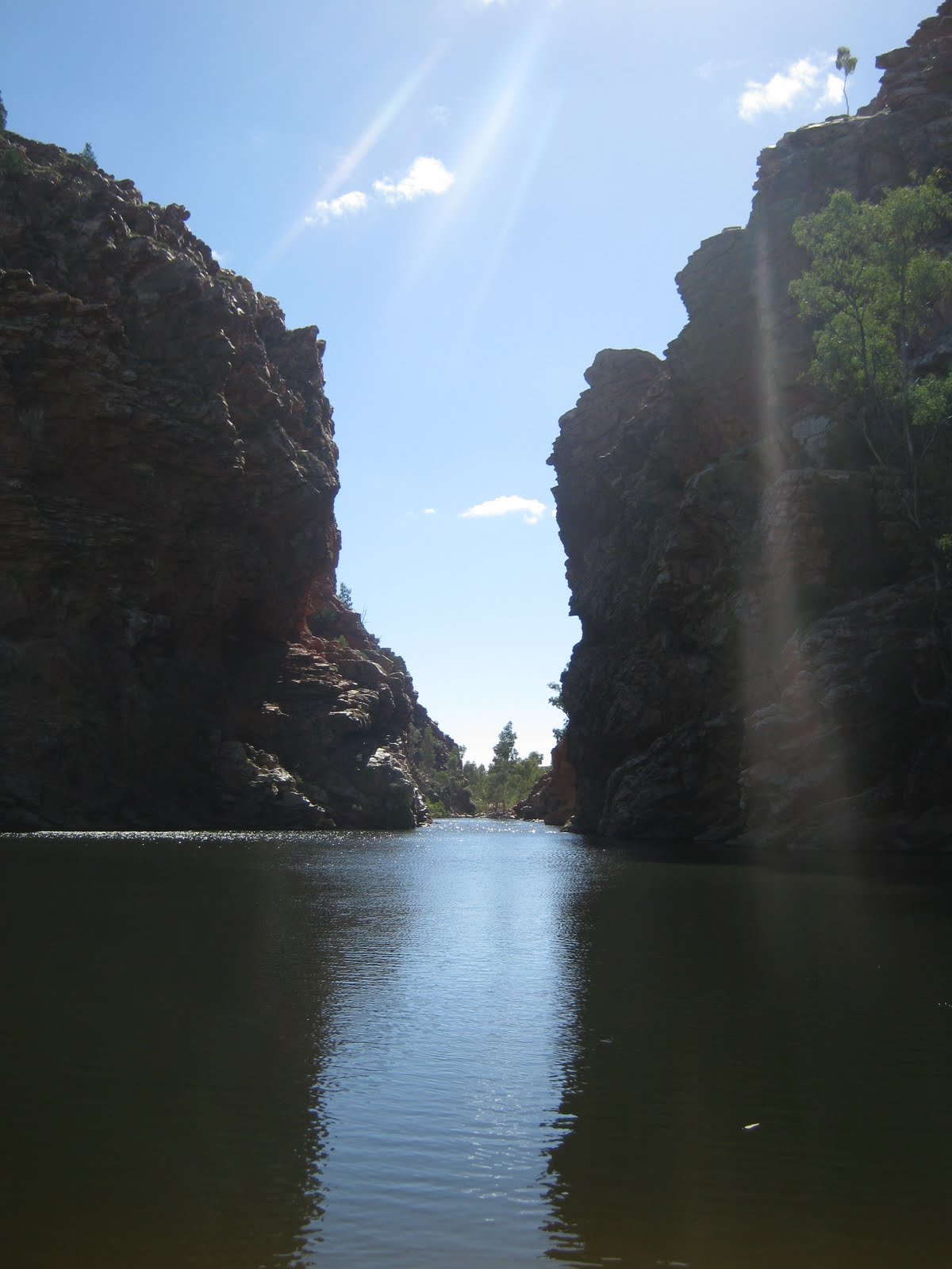 The West MacDonnell ranges are a spectacular sight. The road runs next to the hills which were formed like half barrels next to each other. Along the main road were turnoffs to various points of interest. We stopped at a few of them including Ellery Creek Big Hole and Standley Chasm. Ellery Creek Big Hole is a nice swimming spot where the Ellery creek cuts it's way through the hills. It was a beautiful place. The water was cold and we didn't feel like swimming so we went on a short walk through the hills instead. Standley Chasm was equally beautiful. At midday the chasm catches the suns light and the walls turn orange/red. It was a spectacular place even without the color changes. I always thought that the centre of Australia is Uluru and not much more. But the fact is that there are heaps of amazing things to see.
 The road to Cairns from Alice Springs is also long and boring. But there was a few things worth mentioning. First off we passed the Tropic of Capricorn, the "line" where the tropics officially start. Not that there was palms on the other side or anything :P. We have crossed the Tropic of Capricorn a number of times already during our travels, but I haven't commented on it until now. We also shortly stopped at a small place called Wycliffe Well which claims to be the UFO capitol of Australia. It was half roadhouse/half museum and actually a bit interesting. We passed the Devils Marbles again as well and stopped and explored a new section we didn't last time. I got more great photos. From there and to the Queensland border the landscape was more or less empty and flat with nothing of interest worth seeing.
Subscribe to:
Posts (Atom)