Showing posts with label People. Show all posts

Saturday, July 24, 2010

Fraser Island

On the way towards Rainbow Beach and Fraser Island is Bundaberg, a town known for it's Bundaberg rum and among backpackers for it's working hostels. We didn't go to Bundaberg to work, but we dropped by the distillery. We hoped that the distillery shop had a broad selection of the various non alcoholic drinks that they produce in addition to the liquor, but the shop turned out to be a big disappointment. We also arrived to late in the afternoon for a tour of the distillery. We ended up with a few photos from the outside and a bottle of apple cider.


South of Bundaberg just of the freeway was another large fruit, a huge pineapple. The large pineapple was hollow inside and a staircase went around the inside up to the top. On the inside was a mini museum about the pineapple industry in Australia which was located in the area where we were. At the top was a nice little lookout and you could see pineapple fields to the northeast. Of all the big fruits, animals and other weird things we have seen, the pineapple was the best.

Our next stop was Brisbane. Technically Brisbane is south of Fraser Island and a detour, but we drove the extra 100km south so we could watch the World Cup third place game and final. I was in Brisbane before during my second month in Australia so I am not going to go into details about the city now. What I can say is that I showed Annina around so she could see the city as well. Like I mentioned the main reason we were in Brisbane was because of the World Cup and we watched both games in the Brisbane casino. The casino has free entry, is open 24 hours and has lots of big screens so it was a easy choice. Germany secured the third place and Spain beat the Netherlands, but I am sure you all know that already. After the final was finished and we beat our car getting towed away by like 10 minutes, we drove straight to Rainbow Beach.

Rainbow Beach is a small village next to the south tip of Fraser Island. It is the main gateway to Fraser together with Harvey Bay. While waiting for our Fraser trip's information and safety briefing we walked down to the beach that the town is named after. The name Rainbow Beach comes from the color of the sand on the banks of the beach, from light yellow to dark red. The tour company that we were going with was called Dingo's and was also a hostel. They were very friendly and let us sleep in our car in their parking lot for free. We could also use all of their facilities.

The next morning we got up at 6:30 AM and got ready for Fraser Island. By 7:45 we were all waiting in the parking lot where our rental cars were already waiting. It was no surprise that we were driving Toyota Landcruisers, reputedly the best 4x4 car in Australia. After going through the normal procedures when renting a car and packing all the gear, we got in the cars (8 people in each) and headed for Fraser Island. The type of tour we had booked was a tag along tour which meant that we drove our own car, but had to follow a lead car. Since 7/8 people in our car could drive we had to take turns.

Fraser Island
Fraser Island is the largest sand island in the world at 1840 square kilometers and is among the many World Heritage listed places in Australia. There are over 100 freshwater lakes on Fraser and they are among the cleanest on the planet. The beach that runs along the east coast of Fraser Island is over 120km long. Fraser Island is famous for it's dingo population which is regarded as the purest in Australia due to the isolation from the mainland. Dogs are prohibited on the island to prevent cross-breeding. Dingo's are smart animals and they tried to steal our food several times while we were there. One was hiding under our car just waiting for us to turn our backs to the food.

To get to Fraser Island we had to take a barge (kind of boat) across. It wasn't very far and the whole trip took less than 15 minutes. While waiting for the barge we saw dolphins jumping in the waves. There are no real roads on Fraser Island, you drive on the beach most of the time. Driving on the beach is a bit harder than on normal roads, but is not overly complicated. The main things to remember is to stay close to the ocean where the sand is hardest and to look out for freshwater streams that flow across the sand from the forest edge. It is also important to remember that normal road rules apply.

The first thing we did was to drive to our campsite and set up our tents. Then we headed towards Lake McKenzie, the most famous freshwater lake on Fraser Island. The road to Lake McKenzie went inland through the rainforest and was not much more than a dirt track. The 11 kilometers to get there took over an hour to drive. Lake McKenzie was really beautiful, clear blue water in the middle of the rainforest with white sandy beaches around. In fact it was weird to see such a nice beach next to a freshwater lake, normally the beaches are next to the ocean? Me and Annina went for a short walk next to the lake and enjoyed the view. After Lake McKenzie we drove back to the campsite, made dinner and partied until late.

Our first stop the next morning was a place called Eli Creek. Here a freshwater spring cuts through the forest out to the ocean. A boardwalk is available next to the creek and you can follow that inwards a few hundred meters. Then you can wade back out to the ocean through the creek. The deepest the water gets is just over the knees and the bottom is covered with sand, making it a nice little walk. After Eli Creek we drove further north along the sand on the east coast of Fraser Island until we came to Indian Head. Here we climbed up and had an amazing view both north and south. Out in the ocean we could see dolphins surfing the waves and really far in the horizon a whale was jumping and blowing water.

Between Eli Creek and Indian Head is a shipwreck stuck on the beach called the Maheno wreck. Depending on the tide it is either half way underwater or all the way above. It must have been fairly low tide when we stopped because most of the wreck was above water. I am not sure how old it is, but it was very rusty. However, there was still a good portion of the boat left especially in the front where everyone stood to get a good photo. Since the whole thing was rusting away it was dangerous to go inside. Technically it was illegal to go closer than 3 meters, but nobody cared about that.

The last day we packed up our camp, put everything back into our now sand filled cars and headed for our last destination, Lake Wabby. To get there we had to walk a 2.4km track through the rainforest. In the end the woods opened up into a huge sandblow (the Hammerstone Sandblow) and at the one end was Lake Wabby. It was like a desert surrounded by forest. The bank down to the lake was really steep and the water was freezing. We could see fish swimming around and I also saw a turtle sticking it's head up to get some air. The whole place was very unique. At one place in the sandblow the color of the sand changed from yellow to white for no apparent reason. It was an almost perfect line.
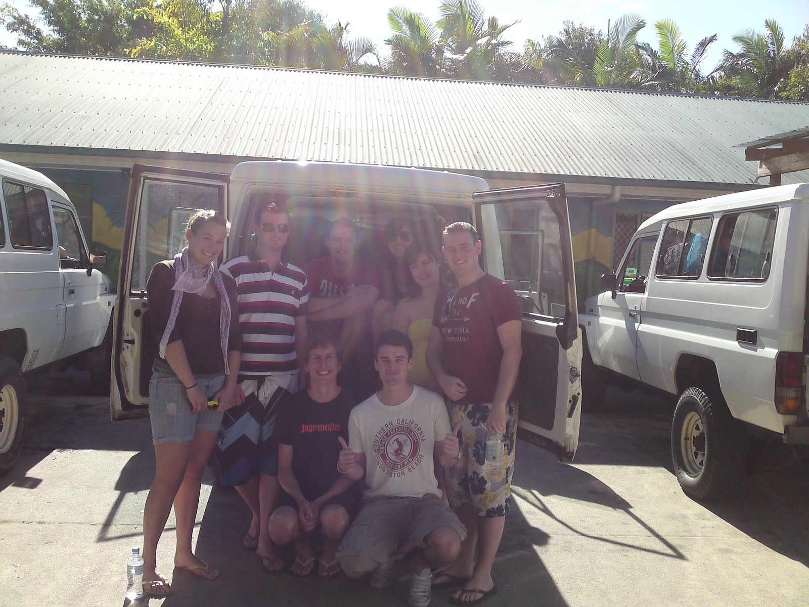
Everyone was pretty exhausted and tired after the hike to and from the lake and because of the party the night before. It was therefore with not to much sadness that we climbed into our cars and headed back for the barge to the mainland. Me and Annina had shared our car with a group of six Irish people, four guys and two girls. They turned out to be incredibly friendly and nice and we had a great time with them. When we got back to Rainbow Beach they even let us use the shower in their hostel room. Thanks Neil, Angela, Shanet, Berry, Paul and Brandon for a wonderful trip!

Fraser Island: 13. July 2010 - 15. July 2010

http://picasaweb.google.com/fatsheep/FraserIsland

Thursday, June 24, 2010

Red Centre (24817km)

The road to Australia's spiritual centre (Uluru) is a long and boring one. There is not much to see on the road before you reach Alice Springs except for the Devils Marbles about 400km north of Alice Springs. This was also the first place we stopped except for eating and sleeping. Devils Marbles are a collection of round stones often balancing on top of each other forming an interesting and seemingly impossible landscape. They are situated not far from the highway with the surrounding area being pretty much flat. My first reaction was wondering how these round balls of rock don't roll off. The answer I don't know, but I am sure it's more logical than it looks. We arrived in the afternoon with he sun low in the sky and the perfect light for taking great photos. I walked around and marveled at yet another great natural wonder that Australia has so many off.

We arrived in Alice Springs the next day and went to the information centre to get brochures about Uluru (Ayers Rock) and the Alice Springs region. I had always though of Alice Springs as a small tourist town out in the middle of nowhere. However the city is actually not that small. Sadly it is also not that nice. I noticed an unfriendly atmosphere that I could not really place. Maybe it was the fact that you had to pay to use public toilets or that the staff (supervisors) at McDonald's were exceptionally unfriendly. We quickly decided to keep driving towards Uluru-Kata Tjuta national park the same day. We dropped off Florence (the French girl) at a hostel and headed south. Uluru-Kata Tjuta is another 450km southwest of Alice Springs.

With about 150km to go I saw what looked like Uluru in the horizon and excitedly pointed to Annina and Nicole. However it turned out it was a mountain called Mt. Conner. From a distance it looks similar to Ayers Rock and it is widely mistaken by tourists on their way to Uluru. We stopped at the lookout along the way and made some photos before continuing on.

Uluru-Kata Tjuta national park is made up of Uluru and another rock/mountain formation called Kata Tjuta (The Olgas). Because we wanted to watch the sunset over Uluru we decided to go to Kata Tjuta first. Kata Tjuta is a series of large rocks/mountains sticking up from the flat landscape. They are different from the Uluru rock and unique in their own way. We first stopped at a lookout and made some panorama shots before going on a short walk next to one of the "domes". It was very interesting to walk next to this weird stone. I remember thinking how amazing it is that these structures are located out in the middle of the desert sticking right out of the landscape. It is hard to try and explain how The Olgas look, so I hope these photos do the job. We also enjoyed a nice lunch next to Kata Tjuta before heading towards Uluru.

Uluru is just 30 minutes away from Kata Tjuta and the red rock rises majestically towards you as you get closer. It is not as big as I had imagined, but it is definitely not small and very impressive non the less. I have heard that people just call it "a rock" but I say it's a very cool rock. There are several places of interest around the bottom of Uluru, a walk that takes you completely around it and a climb to the top. The Aboriginals ask that you don't climb out of respect so we decided to walk along next to it to a place called Kantju Gorge. Along the base of Ayers Rock are many dents and "caves". Some have aboriginal rock art. Looking upwards you can see the uneven shape of the rock and the places where the water flows down when it rains. The further we went the more interesting it became. Sadly we only had time for one walk before we drove out to the sunset viewing area. We even got there a little bit to late with the sun just behind the hills. We still got some great shots and a day full of natural wonders.

Nicole had to go to the airport the next morning so we drove three quarters of the way back to Alice Spring that evening. We then dropped her off, took a shower in Alice Springs and sat down to decide what we were doing next. We both agreed that we had spent too little time at Uluru and that we wanted to go back. We decided to drive the 450km back the same evening and watch the sunrise over Uluru the next morning. We took a slightly different route this time choosing the gravel road instead. Along this road is another meteorite crater called the Henbury meteorite crater. It is much smaller than Wolfe Creek crater but was still interesting to see. The Henbury craters are actually several small craters right next to each other. We did a short walk around them before getting in the car and continuing towards Uluru.

It was now pitch black and driving on the gravel road was a bit of a challenge. Luckily we got to the other side where the sealed road was without problems, or so we thought! We soon realized that something was wrong. First the blinkers stopped working. Then the CD player switched itself on and off continuously. We stopped at the side of the road to have a look what could be wrong and not finding anything we tried to start the car again. But now it didn't want to start. We where now stuck 150km from the nearest roadhouse in the middle of the night. Luckily after just 5 minutes two cars passed us and stopped to help. It turned out to be a family from South Australia. They were extremely nice and helpful. The problem was that the battery was flat so they jumpstarted us. But just five minutes down the road the gas stopped working and the car died while driving. Our alternator was not charging the battery anymore. They then drove the 150km to the roadhouse borrowed a rope and came back. Since they anyways were heading the same place like us they towed our car all the way to Yulara, the small town next to Uluru. Here they dropped us close to the car mechanic. We even woke up the next morning with a great view of Ayers Rock and the sunrise. In our bad luck of having our car breaking down we got extremely lucky. Not only was the family that helped us the only people we saw on the road that whole night, but in the end the problem was our immobilizer. It broke from the battery going empty and stopped the fuel injection. The mechanic disabled it, charged our battery and we were on our way once again.

It is another 300km from Uluru to Kings Canyon. We arrived by midday and decided to do the walk along the edge of the canyon called the Rim walk. It was 6km long. Kings Canyon is a spectacular sight. The path first took us up the steep canyon wall before running along the edge. Sometimes it also went away from the edge and into amazing stone dome formations. There were several great lookouts with breathtaking views of the valley below and the canyon walls. Some places the wall was 100% vertical. About half way through the walk the path went down into a small valley called the Garden of Eden. Here there is permanent water and lush plants and trees grow making it a popular place for animals to find shelter from the harsh landscape all around. Although Uluru is much more famous and visited, Kings Canyon is equally fascinating and deserves to be visited as well.

From Kings Canyon the road is once again gravel and a permit is required because it runs on Aboriginal land. We had already obtained a permit from the Information Centre in Alice Springs and started the drive along the Mereenie Loop as it is called. The landscape around us as we drove was very scenic and the road was fun to drive as well. The Mereenie Loop is part of the Red Centre Way. A loop from Alice Springs through the West MacDonnell ranges and past Kings Canyon and Uluru. We camped that night at a place called Gosse Bluff.

Gosse Bluff comet crater is an ancient crater dating 142.5 million years back. The camp spot where we slept is located inside the inner crater, a 5km in diameter circle of mountains sticking up from the surrounding flat plain. It's hard to see from inside the crater just how big it is. When the crater was first formed there was an outer edge of about 20km in diameter, but this has eroded away and is not visible anymore. We had to drive to a lookout outside the crater wall to get a good photo. There it was easy to see the circle of mountains sticking up.

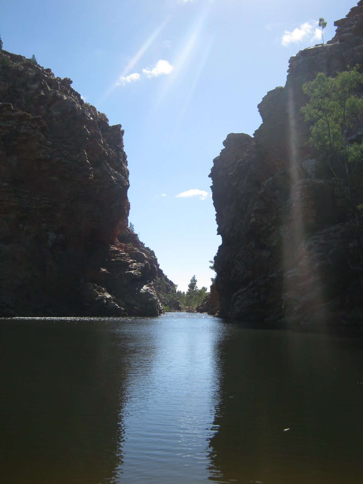
The West MacDonnell ranges are a spectacular sight. The road runs next to the hills which were formed like half barrels next to each other. Along the main road were turnoffs to various points of interest. We stopped at a few of them including Ellery Creek Big Hole and Standley Chasm. Ellery Creek Big Hole is a nice swimming spot where the Ellery creek cuts it's way through the hills. It was a beautiful place. The water was cold and we didn't feel like swimming so we went on a short walk through the hills instead. Standley Chasm was equally beautiful. At midday the chasm catches the suns light and the walls turn orange/red. It was a spectacular place even without the color changes. I always thought that the centre of Australia is Uluru and not much more. But the fact is that there are heaps of amazing things to see.

The road to Cairns from Alice Springs is also long and boring. But there was a few things worth mentioning. First off we passed the Tropic of Capricorn, the "line" where the tropics officially start. Not that there was palms on the other side or anything :P. We have crossed the Tropic of Capricorn a number of times already during our travels, but I haven't commented on it until now. We also shortly stopped at a small place called Wycliffe Well which claims to be the UFO capitol of Australia. It was half roadhouse/half museum and actually a bit interesting. We passed the Devils Marbles again as well and stopped and explored a new section we didn't last time. I got more great photos. From there and to the Queensland border the landscape was more or less empty and flat with nothing of interest worth seeing.

I have been wanting to write about road trains for a while now, but never really did it. I know I mentioned it in my post about the Nullarbor desert, but the ones we saw there are not the real road trains. In the northern part of Western Australia and all of Northern Territory these massive trucks are commonly seen along the highways. They can reach 53.5 meters in length and are truly amazing to see. Think of a semi-trailer with 2 or 3 extra wagons attached. I took this photo of one parked at a roadhouse that we passed. This is not even the longest they can get!

Sunday, June 13, 2010

Top End Pt. 2 (22521km)

Darwin is only a few hours drive from Kakadu and along the way the road runs through the Adelaide river floodplains. We camped at a rest stop in the middle of the wetlands because we wanted to visit an information centre called Window on the Wetlands. The camping spot we chose was possibly the worst choice we ever made. There was literally millions of mosquitoes. We had to burn one of those insect killing sticks inside the car to get rid of them and when we woke up the next morning there was hundreds of dead mosquitoes in the car. On top of the mosquitoes the weather was extremely humid. It was a horrible night. The next morning the information centre turned out to be a positive surprise. It was nice to get our thoughts away from the nightmare that had been.

Darwin
The last few weeks I and especially Annina have been missing a real bed so we decided to sleep in a hostel in Darwin for two nights. We got a nice double room with a awesome bed and a fridge and it felt like a hotel in comparison to the car. We could also buy food that needs a fridge again like cold milk, cheese and butter. Hot showers as often as you want is also a great thing! I really liked the hostel. It had a lot of trees and plants that made it feel like an oasis in the middle of the city.

Apart from relaxing and enjoying our new comforts in the hostel we also went out and explored Darwin. The city is named after the famous Charles Darwin by a friend that wanted to show him respect. The city is quite big for being so far away from everywhere else, around 100.000 people live in the area. One of the attractions we visited was a Taoist/Buddhist temple. There is a lot of Asian people in Darwin (especially Chinese) and they built the original temple in 1887. In 1974 cyclone Tracy destroyed the temple and the building you can see today is a rebuilt version. During WW2 Darwin was bombed by the Japanese and their oil reserves destroyed. The city decided to build underground storage tunnels to protect the oil from the air raids. But by the time the tunnels were completed the war was over. 50 years later the city opened the unused tunnels to the public and they are now the second most visited attraction in Darwin. Since I find stuff like that interesting I visited them as well. It was quite interesting to walk through these massive underground tunnels and to look at photos from WW2 that were on display on the walls.

Because Darwin is so far north the waters are almost always filled with box jellyfish which makes it extremely dangerous to go swimming in the ocean. On top of that there is always a crocodile threat in Northern Territory anywhere where there is water. To make people happy the city has created a project called the waterfront precinct where there is a beach with nets out in the water to stop the jellyfish and a wave lagoon next to it. The wave lagoon was a fun place to relax. Every half hour they make waves for the people to enjoy. You can either just swim around and have fun or grab one of the free bodyboards and go play. When you are bored of the water you can lie down on a beach chair and enjoy the sun. From the waterfront precinct we walked along the coast back to the hostel. The path took us through the Bicentennial park, a long park with lookouts, benches and plagues. My first impression of Darwin were not that great, but it changed as I explored the city.

That evening we went out partying. First we went to a bar where they showed Australia vs. Denmark, a friendship soccer match before the world cup. Australia won. Then we went to three different clubs. The two first were really backpacker places and the last one was more of a mix. We both had a great night and I was pretty drunk in the end :P I can remember eating a monster hamburger on the way back to the hostel and thinking it was the best burger I ever ate :) It was nice to do something different than just sleeping as soon as it gets dark. (There is not much else to do when you are camping at a rest stop along the highway).

We went to the Northern Territory museum and art gallery on our last day in Darwin. Originally we planned to be there for about an hour, but it turned out to be much more interesting than I first thought. It was a nice blend of art galleries and museum exhibitions. Among the highlights was a gallery of indigenous art, a natural history of Northern Territory exhibition, an exhibition about cyclone Tracy and a crocodile exhibition. I think we spent over three hours looking at everything and we still had to hurry through the last few things. I found the natural history section especially good. I took a lot of photos to try and show some of the things that I liked. Here is the album I made from our visit:

Museum and Art Gallery of the NT: 02. June 2010

http://picasaweb.google.com/fatsheep/MuseumAndArtGalleryOfTheNT

Litchfield National Park
We finally had to leave the NT museum and art gallery before it became to late to drive to Litchfield national park. Litchfield is located just south of Darwin and is a popular getaway for locals and tourists alike. There are many waterfalls and plunge pools to swim in and the area is rich in natural beauty. We arrived at a place called Florence falls that afternoon and went for a quick swim in the pool below. You could swim right through one of the two waterfall to a small hollow behind it. Big rocks were visible just under the surface in the middle of the pool and you could sit on them and relax. A few kilometers upstream is a place called Buley rockholes. Here a series of small waterfalls form several rockholes that are ideal for swimming in as well. It was getting to dark to go swimming, but we came back the next day. That night we camped at a campsite next to the rockholes.

Our first destination the next morning was a place called The Lost City. From the main road we had to drive a 4x4 track 10km into the woods. At the end of this road is the "Lost City". The place looks like ruins from a lost civilization. However it is just stone pillars and walls remaining from what was once a permanent layer of rock many many years ago. The place is still very impressive. We walked along the short track between the stone formations and it really did feel like it could have been an ancient civilization living there thousands of years ago.

Our next stop was the Tolmer falls lookout. The falls are not accessible to the public, but there is a walkway to a lookout with great views of them and the surrounding landscape. We then drove to Wangi falls. It is usually a great place to swim, but it was now closed due to increased crocodile risk. The Wangi falls are two waterfalls next to each other both plunging into the same pool below. Since we couldn't go swimming we walked the walking track around the falls instead. It went through moonsoon rainforest at the bottom before climbing up the cliff to the top of the falls. Here we had  a great view of the forest below. It was after the Wangi falls walk that we drove back to the Buley rockholes to swim.

The last thing we did in Litchfield national park was looking at the Magnetic termite mounds. These gigantic termite mounds can get over 2 meters high and are found where there is a clearing in the woods. There are no mammals in Australia that keep the grass growth down like in other parts of the world. Instead millions and millions of termites harvest and eat the grass keeping the natural circle complete. We saw these termite mounds the first time just south of Coral Bay on the west coast and could not understand what they were. From there they are seen everywhere along the whole north part of Australia. The Magnetic termite mounds of Litchfield were the biggest ones we have seen.

On the way back to Darwin we took a small detour so that I could go on a cruise on the Adelaide river. The cruise is famous for showing jumping wild crocodiles. As soon as we entered the boat we saw the first crocodiles swimming in the river. As we slowly cruised upstream the captain talked about the crocodiles living there. The ones that we saw were all saltwater crocodiles which are the biggest of the two species of crocodiles in Australia. They are also the most dangerous and can easily kill a human if they want to. They can get more than 6m long. From the second level of the boat a crew member was dangling pork chops down over the water and crocodiles were jumping into the air to get them. These crocodiles were 100% wild and apparently all crocodilian reptiles have the ability to jump. It was an amazing way to see wild crocodiles close up and to learn more about them. The biggest one I saw was about 4.5m. On the way back down the river at the end of the cruise one of the crew also fed a group of predator birds. She through the food into the air and the birds caught it midair. All in all the jumping crocodile cruise was well worth the money. I left with awesome memories and great pictures.

To save some money on fuel we decided to offer up our two back seats to fellow backpackers that needed a lift to Alice Springs. We posted an add on a website called Gumtree before Darwin and during our stay we decided on two people we wanted to travel with. This was the reason why we had to go back to Darwin after Litchfield national park. Back in Darwin we picked up the first passenger, a German girl called Nicole, and started the long drive south to Alice Springs. The next morning we stopped in Katherine again to pick up our second passenger, a French girl called Florence. It was nice to have some new company especially when you are driving the whole day. It's about 1500km to Alice Springs from Darwin and there is almost nothing to see on the way. As we drove south we also left the Top End and that means the end of this blog post. My next update will be all about the red centre and our journey through it.