Monday, May 17, 2010

Coral Coast Pt. 2 (16610km)

Shark Bay:
North of Kalbarri lies the Shark Bay world heritage area. Around the Peron peninsula is the Shark Bay marine park with tons of different animals and fish. The landscape on land is boring however, just flat plains of small bushes as far as the eye can see. In fact the drive there is ridiculously uninteresting. The first thing we wanted to do was to go to a place called big lagoon, but it was a 4WD track only and it was getting late so we decided not to go. Instead we visited the old Peron Homestead in the Francois Peron National Park. At the homestead they have an outdoor hot tub. The water comes from a bore around 500 meters deep and at a temperature of 40 degrees C.

As I mentioned it was already afternoon when we arrived so we only had time for one more thing before it was getting dark. (It gets dark at 6PM here on the west coast) On the way to the campsite was a place called Eagle Bluff lookout with a great view of the Shark Bay marine park. The campsite was located right next to the water and was great. We had a great view of the sunset while going to bed. The next morning we got up before the sunrise because we wanted to see the dolphin feeding in Monkey Mia. As we were leaving the campsite I took a wrong turn and ended up on a muddy part of the shore. Of course we got stuck and I had to use 4WD to get out. At that moment I was very happy that I bought a 4WD car.

At ten past seven in the morning we were lined up on the beach with the rest of the people that wanted to see the dolphins of Monkey Mia. Every morning since the early 60s they and their earlier generations have come to the beach to get fed and look at the humans, and just like every other day they arrived this morning as well. The dolphins are wild and get fed a third of their daily intake so that they also maintain their normal hunting abilities. The people watching can stand in the water and look at them but are not allowed to touch or pet them. It was still a great thing to see them come all the way into the shallows to get fish, some with their small baby dolphins swimming behind them. I took a lot of photos while I watched them swim around and play.

We also saw a turtle and a baby sting ray or something that looked similar swimming around near shore. On the beach was a couple of big pelicans that also wanted fish. One of the rangers had to feed them away from the shore so they wouldn't steal the dolphins fish. They were really tame and you could get close to them and make photos. Later that day I saw them sleeping on the beach. They looked funny.

From Monkey Mia (which is basically a information hut, a small resort and the beach) I walked a small trail through the dunes. It took me past a old aboriginal cave, a watering hole for birds, some great lookout spots and on the way back along the beach.

In the afternoon I visited the Ocean Park Aquarium while Annina was relaxing at a place called Little Lagoon. The aquarium turned out to be very nice. It was not like a normal aquarium but instead a guided one. The guide took us from tank to tank and explained about the different fish and animals. They also had three bigger pools with fish, the biggest with sharks. Every creature there could be found in the Shark Bay marine park. The most impressive was of course the sharks. The biggest one they had was a tiger shark. The guide dangled a piece of fish from the edge and the sharks tried to get it. One of them, a lemon shark I think, got a good grip of it and the guide lifted it halfway out of the water! They also had sea snakes, turtles and rays. It was informative and a fun place.

I picked up Annina at the Little Lagoon and for fun we drove half way around it on the sand. The lagoon is almost perfectly round. Apparently the water was super shallow all the way across so it was not that easy to swim. We then started our drive back out of the Peron peninsula and Shark Bay. Along the way was shell beach which as the name suggests was covered in shells. More precisely, the whole beach is only shells forming dunes next to the ocean. The thought of a beach made up of only shells is nice, but sand is still more comfortable when it comes to relaxing by the water. A bit further along the road was a place with ancient stromatolites, a kind of living rock that has survived for billions of years. In fact they were one of the first living things on this planet and in Hamelin Pool is one of the only places where they still live today. I have to admit that looking at them was not that interesting.

Carnarvon
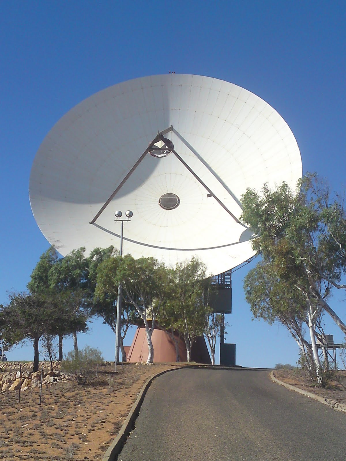
We continued north past Shark Bay to a town called Carnarvon. Here we had to get the car checked at a car garage. It was getting much hotter than normal. It turned out we had a leak in our radiator and it was empty. In Carnarvon I also went and looked at a large satellite dish that was located next to the town. It was built in the 60s by NASA and used among other things during the Apollo space missions. Now it is not used anymore. We also restocked our supplies in Carnarvon before heading north.


In the afternoon we went to a nice camp spot by the beach north of Carnarvon. We wanted to go snorkeling but the waves were to big. Even swimming was risky so we had to stay on the beach and tan instead. Just north of the campsite was a couple of blowholes. A place where the rocks go over the ocean and have holes where the waves gets pushed through with a mighty force creating a fountain up to 20 meters high. We stood there for a while watching and took some nice pictures.

Ningaloo:
We kept on driving north until we arrived at a small holiday village called Coral Bay. It's name comes from the Ningaloo reef that runs along the coast from south of Coral Bay in the south to Exmouth in the north. The Ningaloo reef is one of the most accessible reefs in the world for snorkelers, growing as close as 5-10 meters from shore. Coral Bay is located right next to an amazing beach that stretches around a small bay and just off the shore is the reef. There are almost no waves which makes it ideal for beginner snorkelers and families with kids. It is a wonderful place. We spent two days in Coral Bay snorkeling and getting brown on the beach.

Half a days drive north is Exmouth, a small town also next to the Ningaloo reef. We camped that night at a spot called Thomas Carter Lookout. The road there was steep and narrow and a bit creepy to drive in the dark. The next morning when we drove back down we realised how crazy this road really was. There was steep cliffs on both sides off the road hundreds of meters down into the gorge. We got some amazing views and photo opportunities and were happy we went there.

East of Exmouth is the Cape Range National Park and home to some of the best snorkeling beaches in Australia. Possibly the best one is called Turquoise Bay. As the name suggests the water is turquoise and just off the shore is the Ningaloo reef. There is a spot there where you can do something called drift snorkeling. You swim into the water until you reach the reef, then let the current carry you down along the beach while you watch the scenery below. You then get out again and walk back up the beach for another go. The reef at Turquoise Bay is even better than Coral Bay, with more variety of corals and fish. I saw two octopus's and tons of fish in all imaginable colors, some tiny and others huge. It felt like we had found paradise in the middle of nowhere. With Turquoise Bay the coral coast comes to and end and the great north west begins. The road now takes us inland again and so does our next adventure!

Friday, May 14, 2010

Coral Coast Pt. 1 (14756km)

We started our journey north along the Coral Coast (the west coast north of Perth) by visiting a place called the pinnacle desert. The pinnacles are located about a two hour drive north of Perth close to a small coastal town called Cervantes. We arrived in the afternoon, paid our National Park fee and parked the car. We were met with a weird view as soon as we walked over the hill from the car park. Sticking up from the desert were hundreds of small pinnacles made from sandstone. There was a walking trail and a driving trail through the desert. First we did the walking trail and then the driving trail. Half way through the driving trail we stopped and took pictures in the sunset. The pinnacle desert is one of many natural attractions throughout Australia that makes this country so fascinating and mysterious.

We camped that night at a beautiful rest stop about 30 minutes away. It was a crystal clear night with the amazing Australian sky fully visible. It looks so different from the Norwegian sky. There is a belt of stars across the sky and what looks like the Milky Way. Sadly my camera is not good enough to make any photos to show you.

The next day we continued north. Our next stop was a small town called Jurien Bay. Here we spent a few hours on the beach and had lunch before continuing on. We then made a short stop in a village called Green Head. Our brochure mentioned sea lions in the area, but we saw none.

The next big town after Perth is Geraldton which was also our next stop. Just south of the city grow a special kind of eucalyptus which are known to be extremely hardy. The area is known for it's strong wind from the coast which makes the trees grow sideways. They have become known as the Leaning Trees.

Our first car problem occurred just 10 km from Geraldton. Our front right tire punctured. Punctured tires are not a big problem if you have the right equipment to change it, but that was something I had forgotten to check when we bought the car. So we had to go get help. Luckily a very nice couple helped us out and we were on our way again. We got even more lucky the next day. We were able to buy the spare part that was missing for the car jack for only 2 dollars at a car wrecker and a cheap second hand tire from a second hand tire store.

We didn't do much else in Geraldton. Just a shower, shopping for new equipment and looked at the HMAS Sydney 2 memorial. A memorial for the boat HMAS Sydney 2 that sank during WW2 with it's 650 crew onboard. It wasn't until 2008 that they found the wreck off the coast of Western Australia.

We continued north and made a quick stop just south of a town called Port Gregory. There is a big salt lake here with a special color, pink! It's pink hue is created by bacteria (Dunaliella salina), which becomes trapped in the salt granules. Annina wanted to get really close to the water to make pictures but there was mud under the salt layer on the edge of the lake. She stepped right into the mud and got really dirty. I thought it was funny, but she didn't. :p

Kalbarri
That night we camped just outside Kalbarri and the next morning we started our journey through the Kalbarri National Park. The first attraction was two places called Island Rock and Natural Bridge. The names are pretty self explainable. From the top of the cliffs you have a fantastic view of the ocean down below with a hole in the cliff forming a natural bridge and a lone remaining part of the cliff out in the water forming the island rock.

A few minutes north along the road lay Rainbow Valley. It has it's name from the different earthly colors of the rocks and stone layers. We walked a 1.5 km trail through the valley. It took us past cliffs where you could clearly see the different layers of stone from millions of years ago where the different shorelines had once been. At the bottom of the valley was the mushroom rock, a rock resembling a mushroom.

Where the Murchison river flows out into the ocean on the outskirts of Kalbarri National Park lies the small town of Kalbarri. In Kalbarri we rented a two person kayak and explored the river mouth. It was pretty windy and hard to navigate, but still lots of fun. After an hour of kayaking our arms were hurting and our cloths wet. It was nice to do something different than just driving and walking.

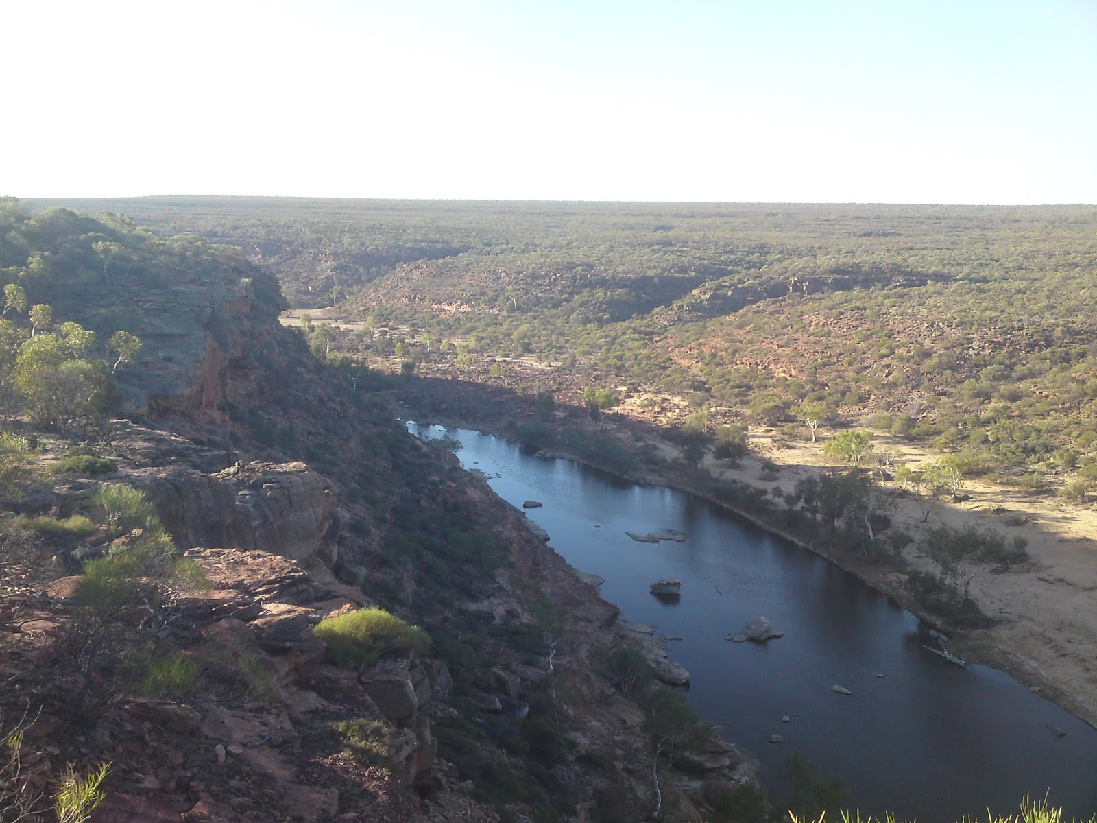
We continued on into the middle of the national park where the Murchison river carves deep gorges through the terrain. At one spot it forms a Z shape and you can see the river flowing deep below you from the lookout post. At least what little water that was left in the river. It is fall here and after a dry summer there isn't much water left. A little bit north from the Z bend is the famous natures window. Located on the top of the cliffs is a rock with a hole through the middle. Looking through it you can see the river down in the gorge below. It is an ideal place to make some amazing photos. We went to two other lookouts as well. The last one had easy access to the river below. We wanted to go for a swim in the river, but there was not much water left and the bank was muddy and wasn't looking that nice. It was still nice to walk down in the gorge. As a bonus we saw two kangaroo's jumping around, I think it was a mother with it's baby.

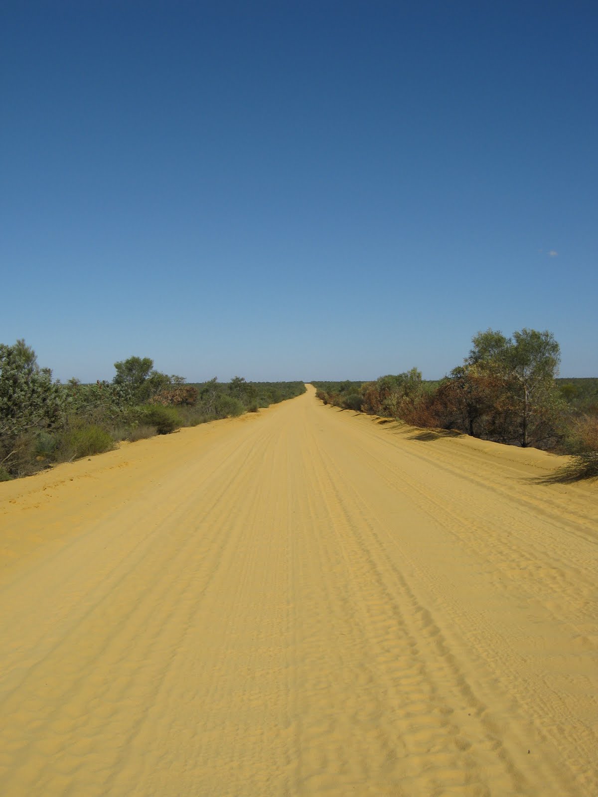
The road out to the gorge is something special. Made from yellow sand it cuts through the landscape. It gives a similar feeling to driving in deep snow. That finishes part one of our Coral Coast adventure. Stay tuned for more!
Wednesday, May 5, 2010

South West (12733km)

Margaret River
We started our trip by heading south from Perth towards a place called Margaret River. Margaret River is a popular vacation destination for local Western Australians with a ton of activities to do. We arrived the second day after camping at a rest stop just north of Bunbury. The first thing we did was visit the information center and grabbed brochures for all the attractions we wanted to do. Then we marked everything on a map and made a route. The first day we visited a Fudge Factory, Candy Factory, Chocolate Factory, a Surf art gallery and a pottery.

In the afternoon we headed to a small place called Gracetown. Krista had told us about a great beach there and we decided to camp there for the night. The beach was really beautiful. We went for a swim and Annina also did some snorkeling, but apparently there wasn't much to see. The rest of the afternoon we relaxed in the sun.

The next day we continued our route. We visited a Coffee factory before heading to where the Margaret River runs into the ocean. There was a great surfing beach and we watched the surfers while walking along the beach. It was a really nice place.

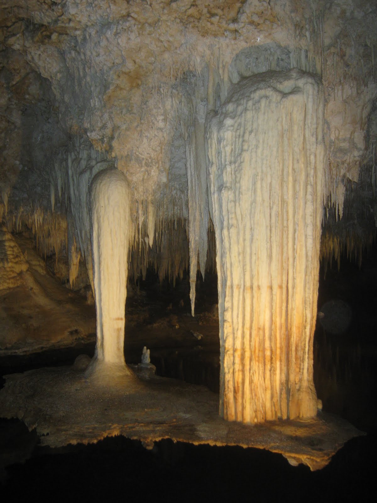
The Margaret River region is riddled with caves, with the biggest and best ones accessible to the public. There are three good caves to choose from, but each cave is $20 so we decided to only visit one. The decision fell on a cave called Lake Cave. It was a great experience. The cave was filled with stalactites and stalagmites, both huge and small, plus a bunch of other decorations I don't even know the name off. The most impressive feature was two stalactites hanging from the roof with a "table" connecting them at the bottom. As far as I remember the combined weight was 5 tonns hanging from the roof over the lake. When we reached the back of the cave we sat down and our guide switched on a light show that ran through the cave. It was beautiful.

The rest of the day we did more attractions including a Forrest Maze, a walk trough the dunes outside a small village called Augusta and Skippy rock before camping at Hamelin Bay.

While we visited Margaret River there was a cow festival on. One of the attractions of this festival was 80 cow statues placed all around the region. Each cow had different artwork painted on them. There was tons of normal cows with every type of pattern imaginable. In addition there was more creative cows, like a teacher cow and a batman cow. The latter was our favorite. It was placed over a crater with wires. Very cool!

Pemberton
After Margaret River we headed towards Walpole and Denmark. On the way we stopped in a small town called Pemberton to buy groceries. It turned out they had an autumn festival going so we decided to stay for a little while and look around. We got the chance to have a big snake around our neck while holding it's head. It wasn't poisonous, but still creepy.

On the outskirts of Pemberton is a gigantic tree that was once used as a lookout post for fires. In fact it's one of three trees that was once used for this purpose, but this one is the tallest of them. It is now open to the public for climbing. In a spiral going upwards are large spikes hammered into the tree forming a ladder of sorts. On the top, 75 meters up, is a two tonne metal lookout platform. Its name: Dave Evans Bicentennial Tree. Climbing this tree was a scary challenge. Not only do you have to look down most of the time while climbing upwards, but you can't help but notice that there is no real safety under you should you fall trough the spikes. Still, it looks harder than it really is and once you reach the top you get a fantastic view of the surrounding area. Off all the things we did on our south west trip, climbing
Dave Evans Bicentennial Tree was my favorite.

Denmark
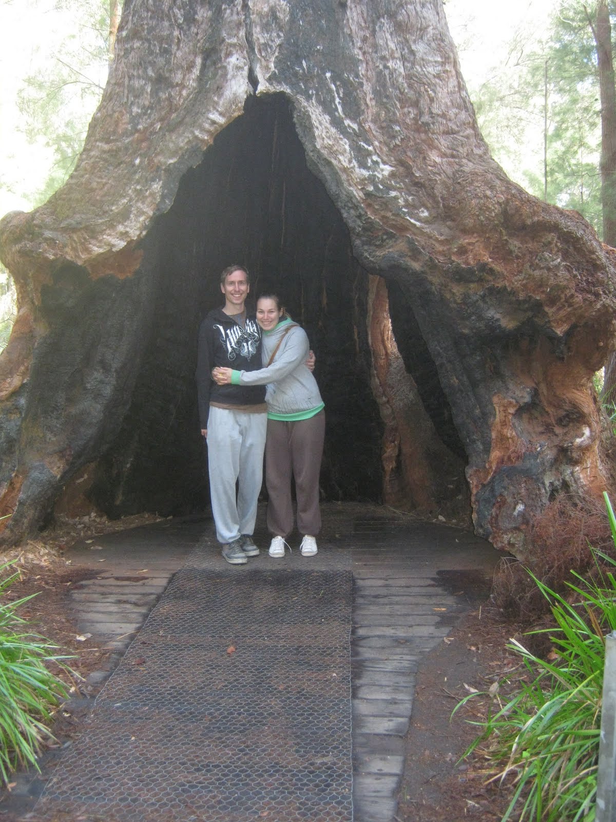
Between Walpole and Denmark is an area called the Valley of the Giants. It is a valley filled with gigantic red tingle trees, a type of eucalyptus. They can reach 60 meters in height. In the middle of the valley is a visitor center with a tree top walk. It reaches 40 meters above ground and takes you through the top of the trees. The tree top walk was fun and exciting and in addition they also had a ground walk that took you trough the trunks of the trees. If you think trees are utterly boring, I suggest going here, as it might spark some interest.

Right outside Denmark along the southern coast is Williams Bay and the most famous attraction there is the Green Pool and the Elephant Rocks. The Green Pool is a series of rocks forming a green looking pool of ocean water, but the interesting part is the waves smashing against the rocks on the outside. It was a windy day and the waves were high which made for some great pictures. Looking at the incredible force of the ocean is a great experience. Right next to the green pool is a bay with rocks that look like elephants, hence the name Elephant Rocks. There was also a cute little beach between the rocks.

The rest of the day we spent by doing wine, cheese and fudge tasting, visiting a chocolate lounge, Denmark Beer Company and Denmark Maze. The Maze was pretty good, built around trees with bushes and grass separating the paths.

Albany
Our last stop in the south west was a town called Albany. Albany was the first place that was settled in Western Australia. We saw the Brig Amity, a replica of the ship that the first settlers came on. Mt. Clarence, a hill in the middle of the town with great views. And Dog Rock, a rock that looks like a dog in profile.


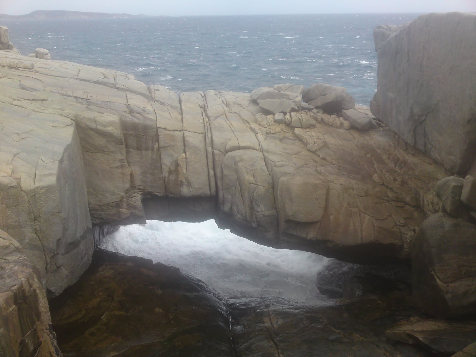
Just south of Albany is several famous natural attractions including the Gap and a Natural Bridge. The Gap is, well a gap 25 meters straight down to the ocean. On the top is a viewing platform with a great view of the waves smashing into the gap with great force. Just next to it is a natural bridge of stone which was also incredible to see. A short drive away was stony hill, with the name explaining just what it is. Here we enjoyed more great views of Albany and surroundings. That night we camped in the north of Two People Bay, another beautiful natural reserve just outside Albany.

The next morning we drove to the south end of Two People Bay to a beach called Little Beach. It was a beautiful beach with turquoise water and white sand. Just behind Little Beach was an even smaller cove where Annina went swimming. I decided not to as it was pretty cold. It is autumn here now and we are in the south of Australia not that far away from Antarctica. We are now heading up north along the west coast and towards warmer weather!

Check out the full picture gallery here:

South West: 28. April 2010 - 04. May 2010

http://picasaweb.google.com/fatsheep/SouthWest

Perth Photos

Just uploaded all my Perth photos to my Picasa profile. Check them out!

Perth: 22. March 2010 - 28. April 2010

http://picasaweb.google.com/fatsheep/Perth