
As we left Kununurra it was only a short drive to the WA/NT border. Here we quickly stopped to make a few photos before continuing on towards the Katherine region. Katherine is about a days drive away from the border and we passed a few small towns on the way. It was quickly becoming clear that Northern Territory has a lot more forests and rivers than Western Australia. We crossed one big river called Victoria River and it must have been one of the biggest rivers I have seen so far in Australia.
Katherine Region

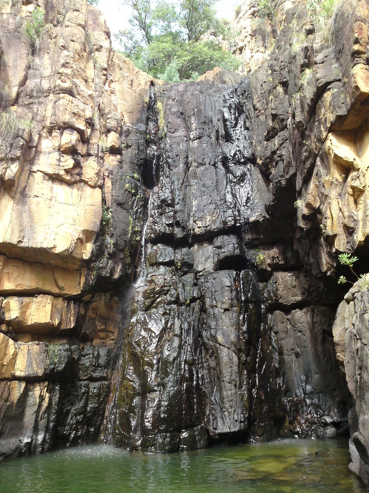
 Just east of Katherine is the Nitmiluk national park also called Katherine Gorge. Here we decided to do a 8.5km walk. First we climbed up the steep cliff to a great lookout of the gorge and the surrounding valley, then we walked through the terrain to another lookout further in. Here the Katherine gorge does a sharp turn and the view was spectacular. Not far from this lookout is a waterfall with a plunge pool below. Annina went for a quick swim in the cool water. It was a tiny oasis hidden away from the surroundings. When we got back to the car our legs were hurting but it had been a nice day!
Kakadu National Park


 The next day we entered the famous Kakadu national park. We first wanted to do the whole place in one day, but we soon realized that Kakadu is way to big for that. Our first stop was a place called Gunlom. To get there we had to drive a dirt road 40km into the forest. It had been raining heavy the night before and the road was flooded several places. Especially two spots were bad. One place the river had risen over the bridge and we had to drive over it without knowing exactly where it was. But we arrived safely at Gunlom. Gunlom soon turned into one of my favorite places in Australia! A massive waterfall plunges into a big pool where you can swim and relax. Because of all the rain the plunge pool was flooded and the surrounding rainforest was full of water. Instead of swimming at the bottom of the waterfall, we walked the short but steep track up to the top. Here several small pools made an idyllic spot to swim and relax. Just upstream a few hundred meters was another smaller waterfall and it was possible to navigate the pools and stream all the way to it. It felt like an adventure! It was also possible to climb all the way out to the edge where the big waterfall plunged down. Here you could stand and look down at the people below and make some amazing photos of the water falling some 30m into the pool below. In the afternoon we wanted to drive back out and go to another place to camp but the bridge where the water was flowing over had now risen to 0.7m over the bridge and it was closed off. Since we could not leave until the next day we got free camping at Gunlom.
 The next day we continued our journey through Kakadu. We stopped at a few lookouts along the Highway before heading towards Nourlangie. Nourlangie is famous for the many aboriginal rock art sites which are open to the public. It is also a important place for the aboriginals living in the area. Here we walked a loop of path that took us past all the different rock art spots and old shelters. This was actually the first place I saw aboriginal rock art in the nature. There was also a couple of lookouts in the area that we went too. One of them was by far better than the others, with amazing views of Kakadu and the Nourlangie cliff.


 The last place we visited in Kakadu was Ubirr. Ubirr is located north in Kakadu on the border to Arnhem Land. Ubirr is another place with many Aboriginal rock paintings. I though the ones at Ubirr were even better than the ones at Nourlangie. Ubirr also has a great lookout over Arnhem Land and it is especially beautiful at sunset. This was what we wanted to see. Many people had apparently the same idea like us and we were a big group of people that watched the sunset. We took some great photos before heading back to the car and driving out of Kakadu. On the way out our car passed 470.000km and when I calculated how far we have driven I realized we just passed half way around the earth! (Equator).
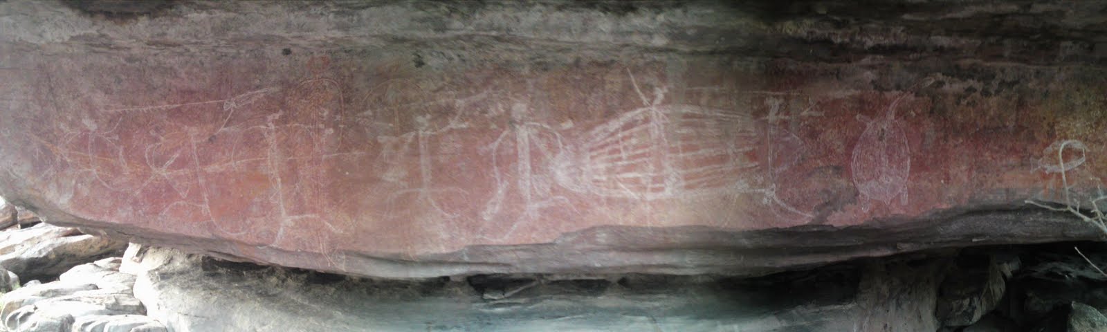
I wonder if you could find a map of Australia on which you can post your route?
ReplyDeleteHehe. I have already thought of that, and I will make one when we are done with our car trip. Which is not that much longer!
ReplyDelete